Tectonic Plate Motion
Introduction
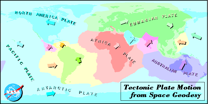
Tectonic motion for points around the world can be estimated from a variety of space geodetic technologies (e.g., satellite laser ranging (SLR), Very Long Baseline Interferometry (VLBI), Global Positioning System (GPS)
among others). In this web-page, the focus is on the results from SLR. With over
15 years of laser tracking data acquired by a network of globally distributed
sites, variations in site positions can be monitored through time. The motions of the plates are largely slow and smooth in nature, with the exception of regions where earthquake activity is high. In these regions, significant surface displacements over a very short time period can and do occur. The results you will find here only represent the generally slow and smooth nature of tectonic motion - displacements directly attributable to earthquakes may not be evident in these results.
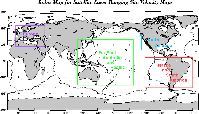
Below, you will find an index map for the regions of the world for which there are SLR site motion results. Unfortunately, for a variety of socio-economic and political reasons, the entire world is not uniformly covered by SLR observatories. If you're interested, you might try the links to VLBI and GPS to discover the parts of the world sampled by those technologies. For the SLR results, use the links below the map to view the SLR estimates of site motions for locations within these regions.
To get the positions and tetonic velocites in SINEX format, ftp 200kb
For further information contact:
Mark Torrence Mark.H.Torrence.1@gsfc.nasa.gov
Raytheon Information Technology and Scientific Services Corporation
Responsible NASA Official: Ben Chao
Original Web Implementation: John W. Robbins
Updated: February 26, 1998
By: Jennifer Wiser Beall
Return to Space Geodesy Branch Home Page